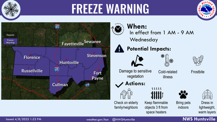
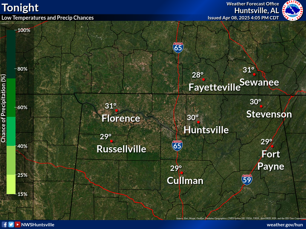
A Freeze Warning has been issued for all counties in northern Alabama that runs from 1AM-9AM Wednesday. Overnight lows will be in the 28-32F range, and conditions will support the development of widespread frost and some freezing fog as well.
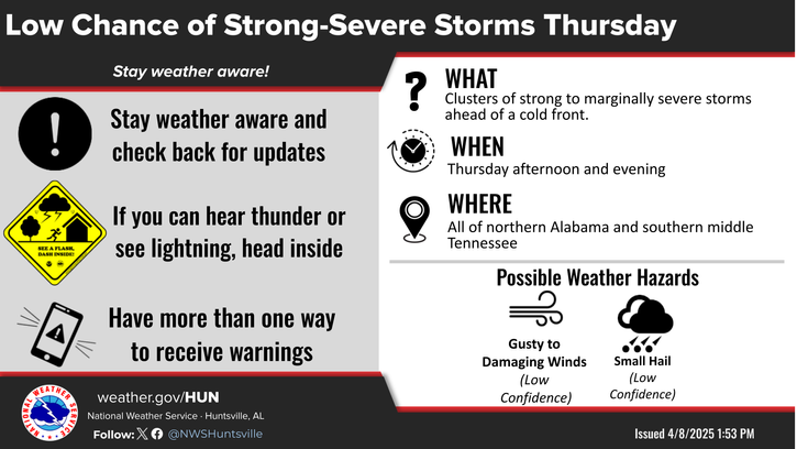
There is a low chance of strong to marginally severe storms Thursday afternoon and evening. The main hazards are gusty to damaging winds, and hail. Make sure to check back for updates and have a severe weather plan in place!
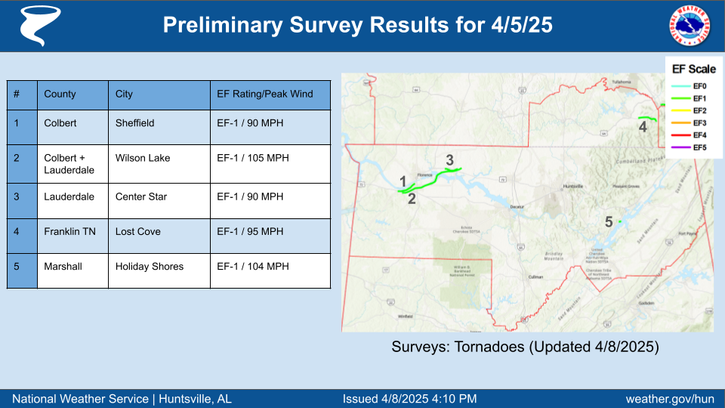
Our survey teams have confirmed 🌪️5 EF-1 tornadoes that occurred with the evening storms on April 5th. They touched down near Sheffield, Wilson Lake, Center Star, Lost Cove TN, and Holiday Shores.
This graphic contains daily climate data (climate normals and records) for today for the sites listed. The legend is in the upper left portion of the image. The current normals period is 1991-2020.
Note: "N/A" or "MISG" will be displayed if values are not available. In the LOCATION column, click on links for a list of recent observations at sites of interest. In the WIND column, VRB is "variable" and G is "gust". Wind speeds are in MPH. In the BARO (pressure) column, values are in inches. In the REMARKS column, HX is "heat index", WCI is "wind chill index", and VSB is "visibility" (if shown).
Text Product Selector (Selected product opens in a new window)


 Local Radar
 Weather Map