Last Map Update: Tue, Apr 8, 2025 at 10:02:27 pm CDT
 |
 |
 |
|||
| SAFE Page | Briefing | Probabilistic Graphics | Past Events | Recent Rainfall | Weather History |
 |
 |
 |
 |
 |
|
| Gridded Forecast | Hourly Forecast | Forecast Discussion | Local Climate | Tornado Database | Submit Storm Report |
| Be Prepared | Estar Preparado |


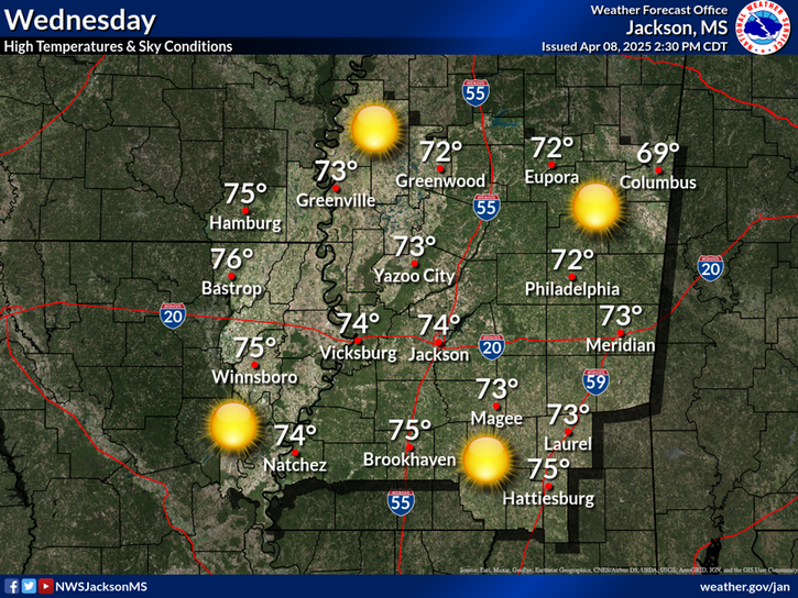
 Local Radar
 Weather Map
 Winter Safety