National Weather Service United States Department of Commerce
Click a location below for detailed forecast.

Last Map Update: Tue, Apr 8, 2025 at 9:50:30 pm CDT

It's important to remember that river flooding continues across a decent portion of the state. The graphic above provides a link to the National Water Prediction Center where you can see the latest river observations and forecasts for gauges across the entire country.
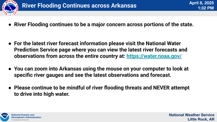
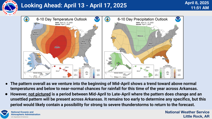
Looking ahead into Mid-April, the trend of warmer temperatures and below normal rainfall will continue for most of Arkansas. However, as we transition into Mid to Late April a pattern shift will result in opportunities for unsettled weather which may equated to strong to severe thunderstorms.
Wednesday morning low temperatures will vary from the upper 30s across northeastern and into north-central Arkansas to the upper 40s across northeast and east-central Arkansas.
Wednesday afternoon high temperatures will vary from the upper 60s in northeast Arkansas into the mid and upper 70s across southwest Arkansas.
On this day in weather history we go back to last year when a Total Solar Eclipse was observed across North America. The path of totality included Little Rock and was the first observed total solar eclipse in Arkansas since June 10, 1918.
Area rivers are either cresting or rising across a large part of Arkansas. Eastern Arkansas rivers were affected the most, with many locations still seeing rising river levels as of this afternoon. If you encounter a flooded roadway, remember the saying "Turn around and don't drown"

 
Hourly Weather Roundup ( )
Location Sky/Weather Temp Dewpt RH Wind Baro Remarks
Fayetteville
N/A
N/A
N/A
N/A
N/A
N/A
N/A
Harrison
N/A
N/A
N/A
N/A
N/A
N/A
N/A
Mountain Home
N/A
N/A
N/A
N/A
N/A
N/A
N/A
Jonesboro
N/A
N/A
N/A
N/A
N/A
N/A
N/A
Fort Smith
N/A
N/A
N/A
N/A
N/A
N/A
N/A
Russellville
N/A
N/A
N/A
N/A
N/A
N/A
N/A
Mount Ida
N/A
N/A
N/A
N/A
N/A
N/A
N/A
Hot Springs
N/A
N/A
N/A
N/A
N/A
N/A
N/A
Little Rock
N/A
N/A
N/A
N/A
N/A
N/A
N/A
North Little Rock
N/A
N/A
N/A
N/A
N/A
N/A
N/A
West Memphis
N/A
N/A
N/A
N/A
N/A
N/A
N/A
Texarkana
N/A
N/A
N/A
N/A
N/A
N/A
N/A
El Dorado
N/A
N/A
N/A
N/A
N/A
N/A
N/A
Pine Bluff
N/A
N/A
N/A
N/A
N/A
N/A
N/A
Monticello
N/A
N/A
N/A
N/A
N/A
N/A
N/A
Note: "N/A" or "MISG" will be displayed if values are not available. In the LOCATION column, click on links for a list of recent observations at sites of interest. In the WIND column, VRB is "variable" and G is "gust". Wind speeds are in MPH. In the BARO (pressure) column, values are in inches. In the REMARKS column, HX is "heat index", WCI is "wind chill index", and VSB is "visibility" (if shown).
 
 
Point Forecasts
Cities in Arkansas Coordinates (make sure "Lon" is negative)
Lat:   Lon:
 
Local Hazards
Local Hazards
Decision Support
Decision Support
Submit Storm Report
Submit Storm Report
Local Forecast Page
Local Forecast Page
Radar Links
Radar Links
Local Climate Page
Local Climate Page
Local Observations Page
Local Satellite Page
Local Drought Page
Local Drought Page
Local Hydrology Page
Local Fire Page
Local Fire Page
Text Product Viewer
Text Product Viewer